Internet search engine provider Google Inc on Thursday released on the Internet panoramic photographs of 34 facilities that were hit by the March 11 earthquake and tsunami last year to preserve images of damage caused by the devastating disaster.
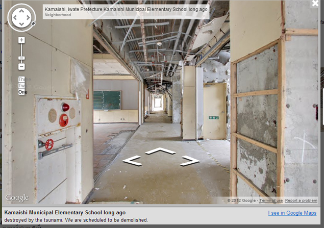
Utilising its "Street View" technology which provides panoramic photos of streets via the Internet, Google's website "Memories for the Future" displays photos of remains such as schools and a fish market, including the exteriors and interiors of the buildings.
"We have taken photos of inside and outside of buildings with a 360-degree view," said Kei Kawai, Google's group product manager who led the project.
Visitors to the website "can feel as if they are inside the buildings," he told a news conference in Tokyo.
The facilities include the former city office of Rikuzentakata, a coastal city in Iwate Prefecture, as well as an elementary school in Namie, Fukushima Prefecture, where the entry of people is restricted due to the nuclear crisis at the Fukushima Daiichi power plant.
Google already shows photos taken from public streets in the disaster-hit areas.
The company cooperated with local governments to take pictures of facilities in Ofunato, Kamaishi, Rikuzentakata in Iwate and Namie, Fukushima Prefecture, before they are scrapped, the company said.
The photos can also be accessed from the company's "Google Maps" web mapping service, it said.
"We are making efforts through trial and error on how to preserve what happened using modern technology," Kawai said.
"We would like people in Japan and the world to see the present state of the disaster-hit areas and Japan," he said.
Google said it plans to add more pictures of facilities in the disaster-hit areas, while it aims to follow up on reconstruction efforts.
The website's URL is http://www.miraikioku.com.
No comments:
Post a Comment